Membership
One membership. The Parcel Dossier and the Site Plan sheets with full dimensions and print, the terrain reading, the site screens, the professional Screens over the active inventory, Territory Watch digests, and the Comp Workspace with its client-ready Comp Exhibit. Facts and drawings from the official record — never a score, never an opinion of value.
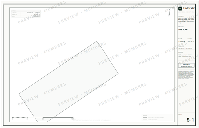
The drawing, beside the price
Locked at $49 for as long as you keep the membership — the price never rises on a founding member.
Billed monthly, renewing until you cancel. Cancel anytime.
The founding rate of $49/month is held for as long as the membership stays active and unbroken. It is not available after the founding cohort closes, and it does not resume if the membership lapses.
Everything in the membership. Cancel anytime — the free record stays free either way.
Billed monthly, renewing until you cancel. Cancel anytime.
ScotianAtlas membership is a paid information service. It is outside the scope of trading in real estate and is not promoted or provided as part of the real estate trading services of Sutton Group Professional Realty. Buying a membership creates no brokerage or agency relationship. Because these services are outside the scope of trading in real estate, the consumer protections administered by the Nova Scotia Real Estate Commission do not apply to them, including regulatory oversight, Errors and Omissions Insurance, and the Real Estate Recovery Fund.
What the membership holds
- The Parcel Dossier — six sections on any parcel in one document: the drawing, the terrain, the registry ledger, the evidence nearby, what it costs to own, and the site screens. On screen first; print or save it as a PDF.
- Site Plan sheets — the dimensioned parcel drawing with streetlines, corner angles, and print/PDF, plus the S-2 terrain sheet: contours, the A–B section, and the slope, relief and aspect read from the provincial elevation model. Compiled from provincial mapping; not a legal survey, and it says so on every sheet.
- Site screens — wetland, waterbody and watercourse (NS topographic base); flood-risk mapping where the province has mapped it; and the arsenic-risk zone for bedrock wells. Each says exactly how it was measured and where it does not reach — a screen that has no coverage says so rather than reading as a clear.
- Screens — the active inventory on the professional axes: days on market, asking cuts and their depth, relists, $/sqft. Facts in columns; you draw the conclusions.
- Territory Watch — a daily digest of what changed in the communities you work: new, pending, sold, cuts.
- Comp Workspace & Exhibit — sold facts and distance around any subject; you pick the comparables, write the notes, and press a client-ready exhibit under your own name. The platform states no opinion of value, and the document says so.
The free tier stays deliberately strong — every record, photo, sold price, and history wall-free. Membership buys the working tools, not the data.